
Survey software by Munga Tech Ltd
Munga GeoSurvey
Survey computations and a control finder, offline, on your phone or computer.
Developed for the work surveyors in Zambia do every day: traverses, levelling, curves, areas, UTM and Lo projections, and finding the nearest survey control. No account, no tracking, and your data stays on your device.
- Version
- 0.7.6
- Runs on
- Web browser now · Android and Windows in preparation
- Coordinate systems
- UTM and Lo on Arc 1950 or WGS 84, local grids
- Your data
- Stays on your device
Find survey control near you
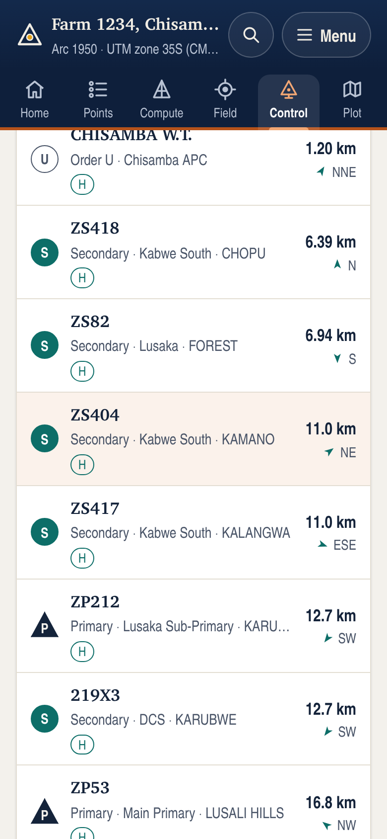
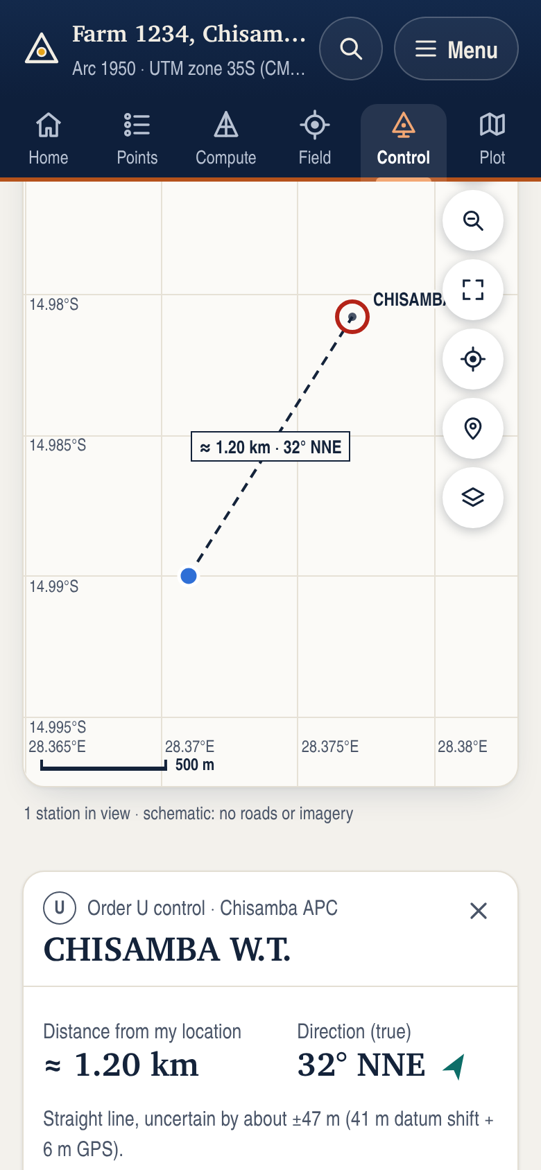
5,579 Zambian control stations are built into the app and work offline. Stand in the field, press one button, and see the nearest marks with how far they are and which way to walk.
- Stations
- 5,579
- UTM zones
- 34S · 35S · 36S
- Datum
- Arc 1950
- Connection needed
- None
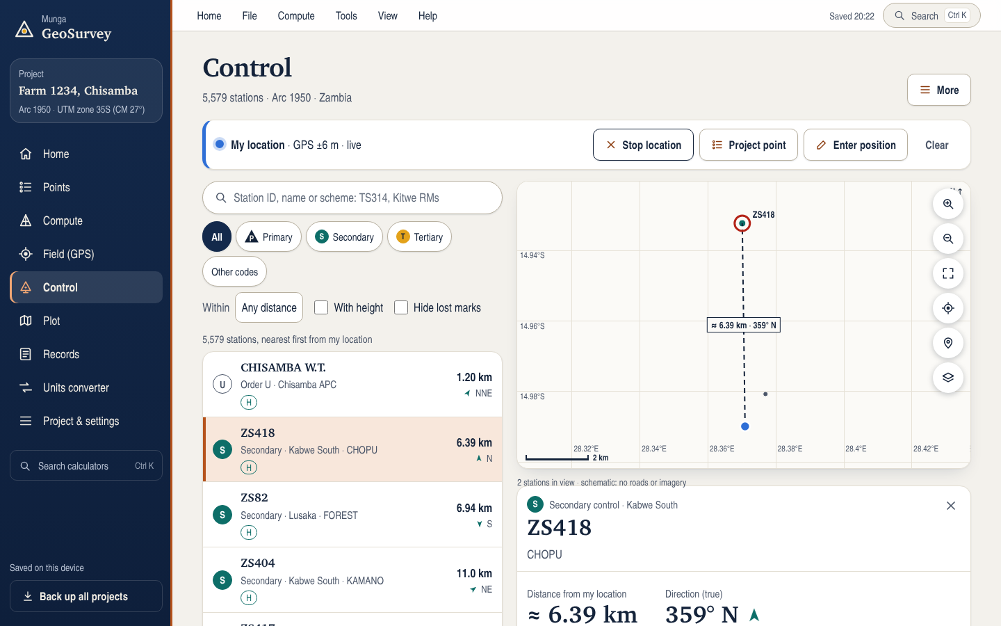
- Nearest firstFrom your phone's location, a point in your project, a typed position or a tap on the map, with distance and true direction to each station.
- Search the whole listBy station ID, name or scheme, offline. Spaces and punctuation do not matter: “ts 314” finds TS314.
- Station cardsRecorded Arc 1950 UTM and Lo coordinates, height, references and data checks, plus the station in your project's own coordinate system.
- Guide meA live compass arrow and distance that update as you walk, and a maps-app link for driving directions.
- Straight into your projectAdd a station with its recorded coordinates, converted exactly into your project's UTM zone or Lo system. From one of your points, the exact grid bearing and distance.
- Recovery logRecord each mark as found, disturbed, destroyed or not found, with the date and notes, and export the log.
Station coordinates are the recorded Arc 1950 values and go into projects unchanged. Distance and direction from your phone use the EPSG:1120 shift, accurate to about 41 m, plus GPS error: they lead you to the area of a station, and the mark is identified from its description and references.
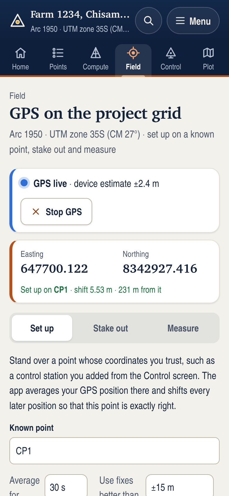
Set up, stake out and measure with GPS
- Set up on a known pointStand on a mark with trusted coordinates and average the phone's GPS there. Every later position is shifted to match, which applies a local translation. Verify it on a separate known point; it does not establish rotation, scale or absolute accuracy.
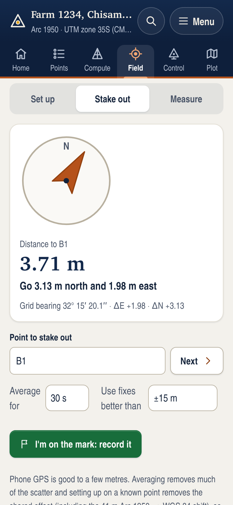
- Stake outLive distance and plain directions (“go 2.10 m north and 2.47 m east”) with a compass arrow. Record where each mark went and keep a stakeout report.
- MeasureAverage a position, reject poor and stray fixes, and save it as a point. Enter an existing ID to check a known point instead.
- Free OpenStreetMap, when onlineShow a free OpenStreetMap street map under the control map and your project plot (UTM and Lo projects). Off by default, and the app goes back to its own offline map when there is no connection.
- Honest accuracyThe app shows device-reported accuracy and sample spread separately. Neither confirms absolute accuracy or an external receiver's RTK status.
29 survey calculators
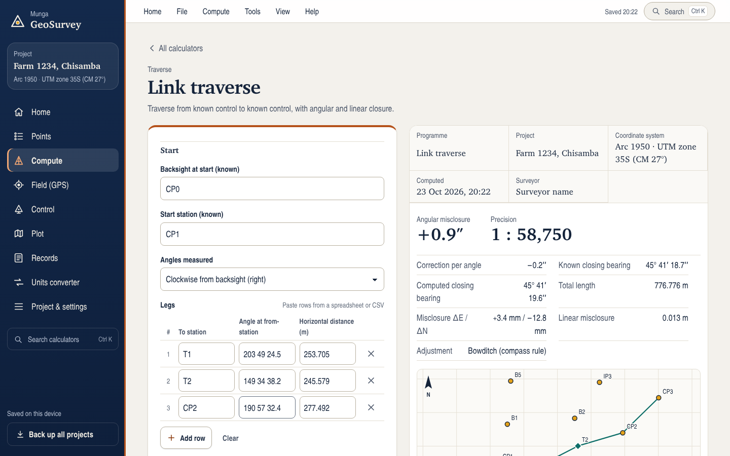
From a parcel area to a link traverse closed on control, in four categories, as in the app’s Calculators menu.
Coordinates & areas
- Area & parcels
Parcel area and boundary schedule · Area subdivision
- Coordinates
Join · Polar point · Radiation from directions · Chainage & offset
- Intersections
By bearings · By directions · By distances · Line–line
Traverse & resection
- Traverse
By bearings · By angles · Link traverse, control to control
- Resection
By directions · By distances
Setting out & heights
- Setting out
Setting-out sheet · Horizontal curve with pegging table
- Heights
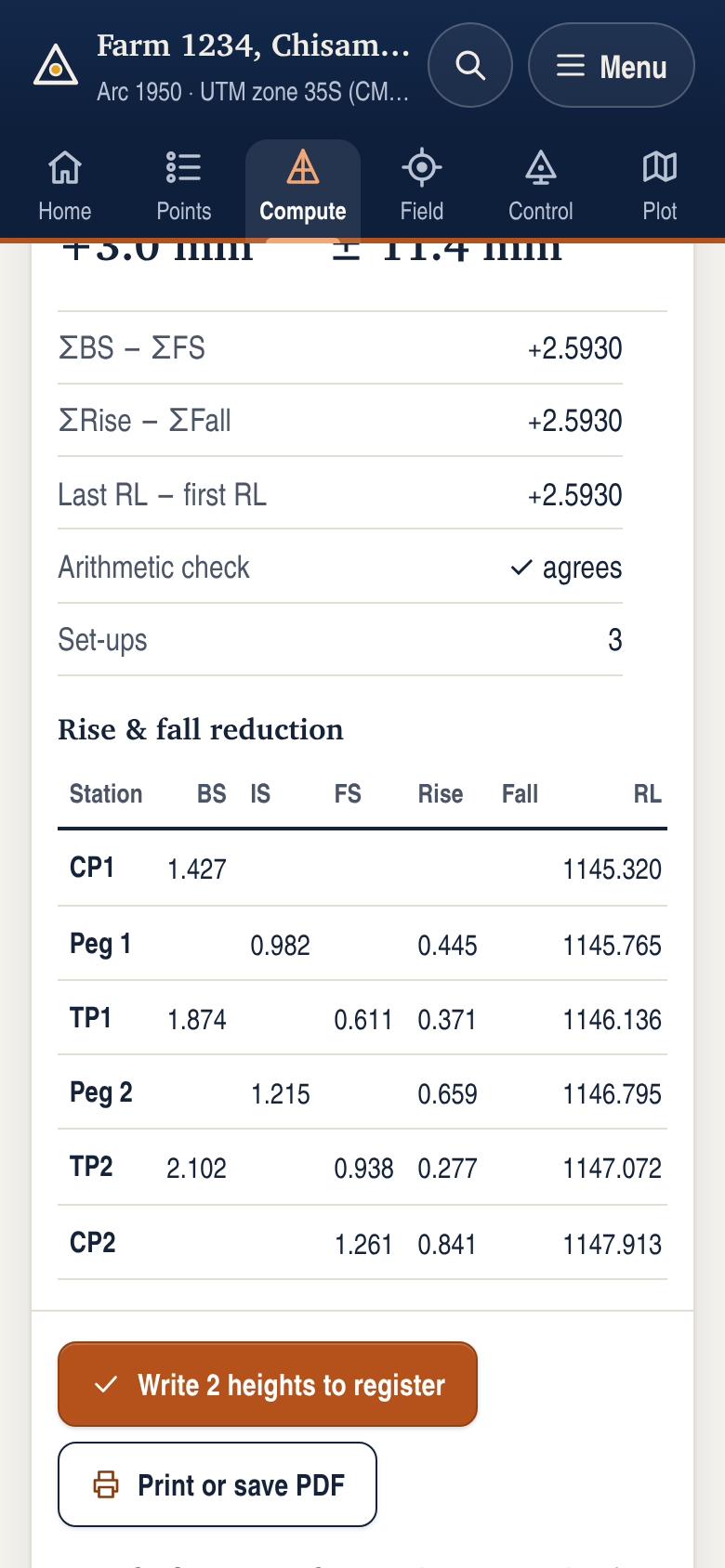
Levelling: rise & fall or height of collimation · Trigonometric heighting · Slope & sea-level reduction · Volumes from cross-sections
Transformations & projections
- Transformations
Helmert from common points · Helmert with given parameters
- Projections & datums
Geographic to grid · Grid to geographic · UTM to Lo and back · Scale factor & convergence · Combined scale factor · Arc 1950 to WGS 84 and back
Computation sheets you can file
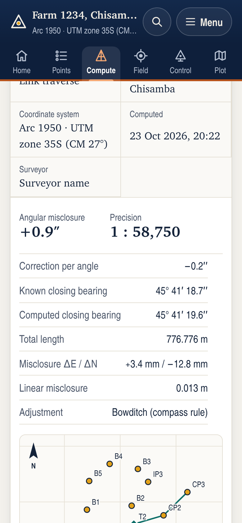
- Every result is a computation sheet with a title block: programme, project, coordinate system, date and surveyor.
- Closures, misclosures, precision and arithmetic checks are shown with the results, never hidden.
- Calculated points go into the project register in one tap; heights can be written back to existing points.
- Every calculation is kept in the project record, so a sheet can be reprinted or reopened with its inputs.
- Print or save sheets as PDF. Export points to CSV, DXF (AutoCAD), shapefile, KML (Google Earth) and GeoJSON (GIS).
- Export the plot as a scaled PDF drawing with title block, north arrow, scale bar, grid, boundary distances and bearings, or as DXF, shapefile, SVG or PNG.
- Works like desktop survey software: projects you create, open and save as files, a Home screen, and File, Compute, Tools, View and Help menus with keyboard shortcuts.
- Search every calculator and tool from one box, and convert units: feet, US survey feet, chains, acres, hectares, Cape feet and morgen, gon, slope and volume.
- Paste observations straight from a spreadsheet. Angles in degrees, minutes and seconds or decimal degrees.
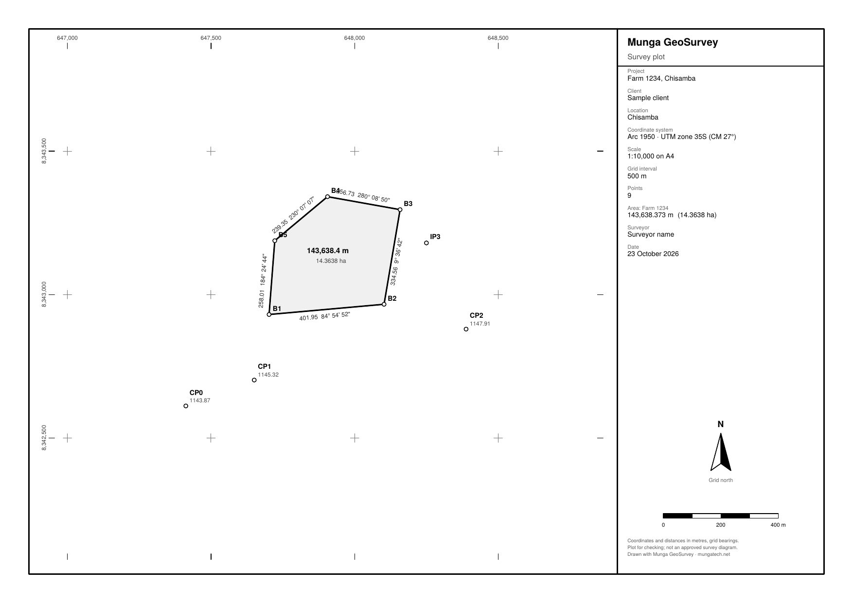
Plans from your data
Export the project plot at a standard scale, ready to print, send or open in CAD and GIS.
- PDF drawing on A4 or A3 with title block, grid north arrow, scale bar and coordinate grid.
- Point IDs and heights, boundary distances and bearings, and the parcel area.
- DXF in ground coordinates, on separate layers, for AutoCAD and other CAD software.
- Shapefiles with attributes and projection for QGIS and ArcGIS; SVG and PNG images.
A plot for checking and sharing, not an approved survey diagram.
Checked against independent references
The calculations are tested automatically against published examples and known geometry before every release.
- Projections
80 reference values from PROJ, the standard projection library, and the worked example in Snyder's Map Projections — A Working Manual.
- Distances to control
Vincenty's formula, checked against Geoscience Australia's Flinders Peak to Buninyong example to 1 mm.
- Traverses, resections, intersections
Hundreds of random survey layouts: the true geometry is built first, then the app must recover it from the observations.
- The control list
Every station re-computed by the app's own engine. Two stations whose Lo and UTM listings disagree, and 24 recorded on another datum, are flagged in the app.
Results depend on correct observations and parameters. Check calculations independently before using them for cadastral, legal or construction purposes.
Private by design
Survey data belongs to you and your clients. The app is built so that it never leaves your device unless you export or share it.
- No accountOpen the app and start. Nothing to sign up for.
- No advertising or trackingNo analytics, no advertising and no third-party code.
- Works offlineAfter the first visit the web app runs without a connection. The optional OpenStreetMap background needs a connection, with no account or API key.
- Location only when you askUsed on the device to find nearby control and to set up, stake out and measure. Raw positions are never stored or sent anywhere.
Get Munga GeoSurvey
One app, the same programmes everywhere. Back up your projects to a file and open them on another device.
Web app
AvailableRuns in a current browser such as Chrome or Edge, on phones, tablets and computers. In Chrome or Edge, choose “Install app” to add it to your home screen or desktop. Works offline after the first visit.
Open the web appAndroid
In preparationFor Google Play, with the same programmes, the control finder and full offline use.
Windows
In preparationA Windows installer for office computers, with native save dialogs and printing.
Questions
Does it need an internet connection?
No. All calculations and the control list are on the device. A connection is needed only to load the web app the first time, and for optional OpenStreetMap basemaps or external navigation links.
Which coordinate systems does it support?
UTM (any zone) and Lo (Gauss conform, West/South or East/North axes) on Arc 1950 or WGS 84, and local grids. Datum changes between Arc 1950 and WGS 84 use EPSG:1120 or your own 3- or 7-parameter set.
How accurate is the control finder?
Station coordinates are the recorded Arc 1950 values and are added to projects unchanged. The distance and direction from your phone use the EPSG:1120 shift, accurate to about 41 m, plus your phone's GPS error. They take you to the area of a station. Identify the mark from its description and references.
Can I use it for cadastral or legal work?
The app shows every check with its results, but results depend on correct observations and parameters. Check calculations independently before using them for cadastral, legal or construction purposes.
Where are my projects stored?
Only on your device, in the app's own storage, saved automatically as you work. Save a project as a file (Save project as file, under File) to keep it elsewhere or open it on another device, and make a backup of everything regularly. Backups include your projects, recovery log and your own control.
How accurate is the GPS on a phone?
Phone positions are approximate. Averaging can reduce scatter, and a known-point setup applies a local translation, but neither guarantees a particular accuracy. Check a separate known point. A low reported error does not prove an external receiver has a fixed RTK solution. Use appropriate survey equipment and independent checks for cadastral or construction setting out.
Can I see my survey on a satellite photo?
Yes, when you are online. Under View, Map background, choose Google map, Google satellite or Satellite with labels. The control map and the project plot then show Google's map behind your stations, points and boundary. For Arc 1950 projects the photo is placed using the published Arc 1950 to WGS 84 shift, with a published transformation accuracy of about 41 m, plus source and imagery errors. Use it to recognise features, not to measure. Without a connection the app uses its own schematic map. Exports never include the photo.
Can I export a plan of my survey?
Yes. Export plot, under File, makes a PDF drawing at a standard scale on A4 or A3, with a title block, north arrow, scale bar, coordinate grid, point IDs and heights, and boundary distances, bearings and area. The same plot exports to DXF for CAD, shapefiles for GIS, and SVG or PNG. It is a plot for checking, not an approved survey diagram.
Can I add my own control?
Yes. Import a CSV of your own stations (ID or name, easting, northing, UTM zone, and optional height). They appear in the list and on the map, marked as yours.
Need the survey done, not just computed?
Munga Tech Ltd carries out boundary, topographical, GIS and engineering surveys across Zambia.